Deflating Polygons in Leaflet
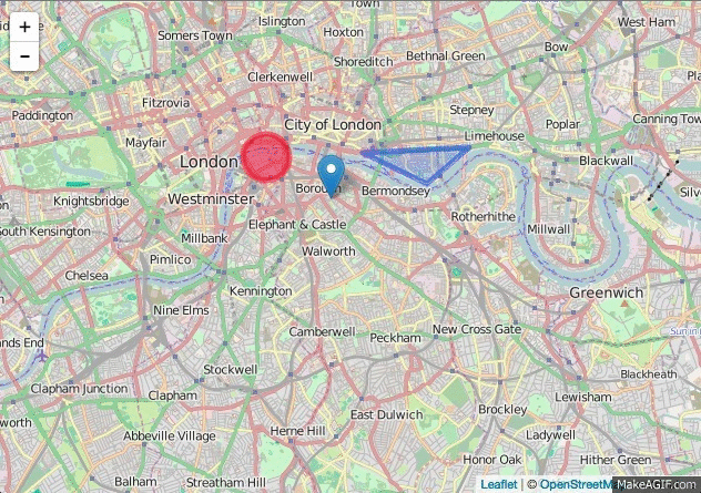
A common problem with dynamic web maps is the way polygons and lines are displayed in lower zoom levels. At some point, these geometries become too small to be noticeable on the map. A straight forward solution is to replace the polygon or line with a marker at the feature’s centroid position.
The new Leaflet plugin Leaflet.Deflate does just that. Read on to see how it works.
The basics
The (slighlty) tricky part is to determine when a feature actually is too small, as it depends on both the geographical size of the feature and the scale of the map. A scale-independent unit, which also happens to be the universal unit on computer screens, is the pixel. Hence, calculating the pixel size of the polygon on the screen and switching between marker and polygon display when the pixel size falls below a certain threshold is the approach that was implemented in the plugin.
The good thing is, Leaflet already provides us with all the basic functionality necessary to implement this approach.
Identifying the threshold zoom level
The following snippet demonstrates how we determine the polygon screen size.
function isCollapsed (path, zoom) {
    var bounds = path.getBounds();

    var ne_px = map.project(bounds.getNorthEast(), zoom);
    var sw_px = map.project(bounds.getSouthWest(), zoom);

    var width = ne_px.x - sw_px.x;
    var height = sw_px.y - ne_px.y;
    return (height < this.options.minSize || width < this.options.minSize);
}
Here’s how it works:
- Get the bounding box of the feature. Using the bounding box makes calculations a lot simpler when compared to complex geometries.
- The
Boundsobject provides the coordinates of its north-east and south-west corners. UsingMap.project(<LatLng>, zoom)we can get the pixel coordinates of both corners. - Now its possible to calculate the bounding box’s width and height in pixels.
- Finally, all we need is to compare the dimensions against a pre-set threshold value (the
minSizeoption). For simplicity, the function just checks if bothwidthandhightexceed the threshold value. - The function returns
trueif one of the values is lower than the threshold.
Determining the minimum zoom level for a feature
Now we can determine the threshold zoom level for each feature when the display should swap between a marker and its actual geometry. We determine that threshold as soon as the feature is added to the map so we don’t have to do any calculations every time the map is zoomed.
The following function determines the threshold zoom.
function getZoomThreshold (path) {
    var zoomThreshold = null;
    var zoom = map.getZoom();
    if (isCollapsed(path, map.getZoom())) {
        while (!zoomThreshold) {
            zoom += 1;
            if (!map.isCollapsed(path, zoom)) {
                zoomThreshold = zoom - 1;
            }
        }
    } else {
        while (!zoomThreshold) {
            zoom -= 1;
            if (map.isCollapsed(path, zoom)) {
                zoomThreshold = zoom;
            }
        }
    }
    return zoomThreshold;
}
Here’s how it works:
- Get the current zoom level of the map.
- Check if the feature should be displayed as a marker at the current zoom level; using the method discussed previously.
- Depending on that information, we have to increase or decrease the zoom level until
isCollapsedchanges its status to determine the threshold.
Adding the feature to the map
When a new feature is added to the map, we can now pre-calculate the zoom threshold and the replacement marker. We register an event handler for the layeradd event that is called every time a feature is added to the map.
Because the handler will be called every time we swap between marker and the original geometry, the calculation should be carried out only once — when the feature is added to the map the first time. That’s why we check if zoomThreshold and marker are not already assigned to the feature. By further checking if getBounds method is present, we ensure that the we calculating everything for two-dimensional features only (which excludes points).
map.on('layeradd', function(event) {
    var feature = event.layer;
    if (feature.getBounds && !feature.zoomThreshold && !feature.marker) {
        var zoomThreshold = getZoomThreshold(feature);
        var marker = L.marker(feature.getBounds().getCenter());

        feature.zoomThreshold = zoomThreshold;
        feature.marker = marker;

        if (this.getZoom() <= zoomThreshold) {
            map.removeLayer(feature);
            map.addLayer(feature.marker);
        }
    }
});
Replacing markers after zooming the map
Whenever the user zooms the map, we just need to compare the map’s current zoom with the pre-calculated threshold of each feature. We do that in a handler function we registered on Leaflet’s zoomend event.
Within the event handler we iterate over all features in our map and replace the feature with a marker if the current zoom is lower than the zoomThreshold. We also store the feature in removedTemp for now.
All features that have already been replaced with markers are stored in the global removedPaths. We iterate over all elements in that Array to check whether each marker can be replaced with its original feature again.
Finally, we join removedTemp to removedPaths to store all replaced features in one place.
removedPaths = [];

map.on('zoomend', function () {
    var removedTemp = [];

    map.eachLayer(function (feature) {
        if (map.getZoom() <= feature.zoomThreshold) {
            map.removeLayer(feature);
            map.addLayer(feature.marker);
            removedTemp.push(feature);
        }
    }, this);

    for (var i = 0; i < removedPaths.length; i++) {
        var feature = removedPaths[i];
        if (map.getZoom() > feature.zoomThreshold) {
            map.removeLayer(feature.marker);
            map.addLayer(feature);
            removedPaths.splice(i, 1);
            i = i - 1;
        }
    }

    removedPaths = removedPaths.concat(removedTemp);
});
To see how these parts work together, have a look at the plugin’s source. Feel free to raise an issue if you spot something that needs improvement.